


195MIL - MILL Voting District, Madison County, Georgia
About
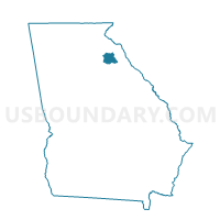
Outline

Summary
| Unique Area Identifier | 562463 |
| Name | 195MIL - MILL Voting District |
| County | Madison County |
| State | Georgia |
| Area (square miles) | 35.42 |
| Land Area (square miles) | 35.06 |
| Water Area (square miles) | 0.36 |
| % of Land Area | 98.98 |
| % of Water Area | 1.02 |
| Latitude of the Internal Point | 34.19654430 |
| Longtitude of the Internal Point | -83.19361720 |
Maps


Graphs
Select a template below for downloading or customizing gragh for 195MIL - MILL Voting District, Madison County, Georgia


Neighbors
Neighoring Voting District (by Name) Neighboring Voting District on the Map
- 105201 - GOSHEN Voting District, Elbert County, GA
- 1197 - MIDDLE RIVER Voting District, Franklin County, GA
- 1199 - GUNNELLS Voting District, Franklin County, GA
- 195COL - COLLINS Voting District, Madison County, GA
- 195DAN - DANIELSVILLE Voting District, Madison County, GA
- 195HAR - HARRISON Voting District, Madison County, GA
- 195POC - POCA Voting District, Madison County, GA
Top 10 Neighboring County Subdivision (by Population) Neighboring County Subdivision on the Map
- Ila CCD, Madison County, GA (5,481)
- Comer CCD, Madison County, GA (4,256)
- Danielsville CCD, Madison County, GA (4,114)
- Bowman CCD, Elbert County, GA (3,527)
- Sandy Cross CCD, Franklin County, GA (3,245)
- Broad River CCD, Madison County, GA (1,990)
Top 10 Neighboring Unified School District (by Population) Neighboring Unified School District on the Map
- Madison County School District, GA (28,120)
- Franklin County School District, GA (22,084)
- Elbert County School District, GA (20,166)
Top 10 Neighboring State Legislative District Lower Chamber (by Population) Neighboring State Legislative District Lower Chamber on the Map
Top 10 Neighboring State Legislative District Upper Chamber (by Population) Neighboring State Legislative District Upper Chamber on the Map
Top 10 Neighboring 111th Congressional District (by Population) Neighboring 111th Congressional District on the Map
Top 10 Neighboring Census Tract (by Population) Neighboring Census Tract on the Map
- Census Tract 201, Madison County, GA (5,481)
- Census Tract 203, Madison County, GA (4,256)
- Census Tract 202, Madison County, GA (4,114)
- Census Tract 1, Elbert County, GA (3,527)
- Census Tract 8903, Franklin County, GA (3,245)
- Census Tract 206, Madison County, GA (1,990)